

EO4SD forest management
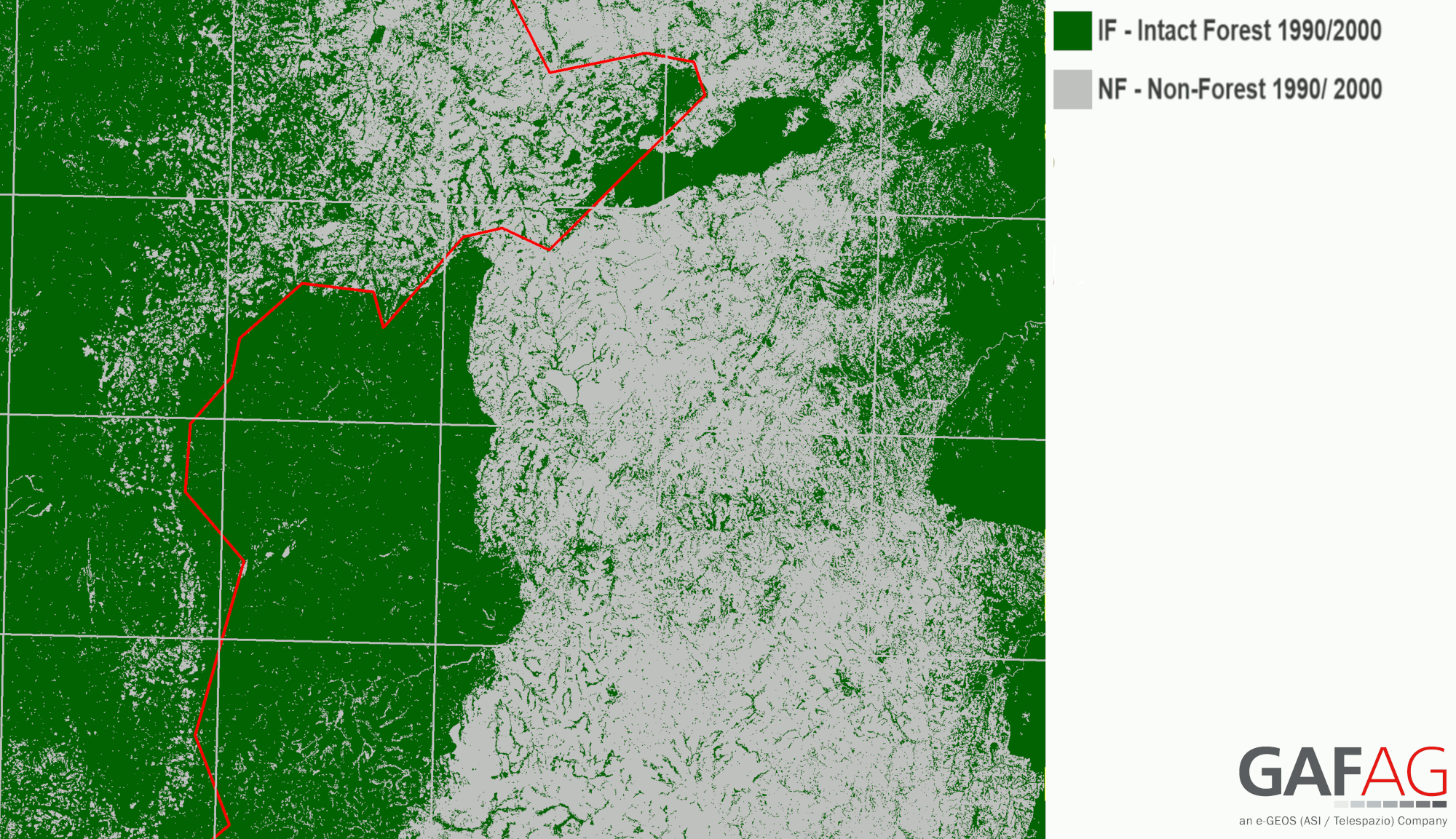
This product shows fully-stocked and degraded forest areas at a given point in time.
The Intact/Non-Intact Forest Status is derived through an indirect approach where land use/cover classification results from high resolution satellite data and ancillary data (e.g. roads, waterways, settlements, etc.) are assessed through geospatial analyses within a Geographic Information System (GIS). EO-based forest cover maps or land use/ land cover Maps from different years (usually at the beginning and the end of a reporting period) can be classified into intact and non-intact forest areas as input for Emission Factor (EF) assessments.
Intact forest is fully-stocked, which means that the forest has tree cover between the minimum percentage that is required to be defined as ‘forest’ (e.g. 10%) and complete coverage (100%). An intact forest must be undisturbed, i.e. there has been no timber extraction.
Non-intact forest is not fully-stocked but tree cover must still be above the minimum tree cover percentage threshold of the applied forest definition (e.g. 10%) to qualify as ‘forest’. A non-intact forest has undergone some level of exploitation or canopy degradation. The emission factor (EF) assessment in these two classifications can most efficiently be implemented through terrestrial sample inventories. The difference in carbon stock per hectare between the two classifications will be the emission factor for the degradation change area between two different years.
The Intact/ Non-Intact Forest Status product can be used as an input for:
- Assessment of Activity Data for REDD+
- Analysis of Degradation and deforestation
- Sustainable Forest Management (SFM)
- Planning of Forest Landscape Restoration (FLR)
- Community-based REDD+
- Identification of High Carbon Stock (HCS) forests
In the context of REDD+ the estimation of forest degradation caused by anthropogenic activities over a given time period can be represented by a decrease in canopy cover that does not qualify as deforestation. The main causes of forest degradation are usually exploitation of fuel wood, subsistence agriculture, fire, selective exploitation of commercial wood, etc. Monitoring degradation-related changes using EO methods is complex as this generally entails relatively dynamic processes as opposed to permanent land use changes.
In woodland or dry forest ecosystems, the changes in forest canopy cover will only be apparent in satellite images when they are not small and when they produce systematic patterns in the imagery. Therefore, terrestrial forest inventories, combined with forest area change mapping would be the optimal tool to properly identify and quantify changes in forested area and related carbon stock.
PRODUCT SPECIFICATIONS
CONTENT
- Detailed mapping of intact and non-intact forest within a forested area. This can be based on the input of a forest land and non-forest land product or on a detailed land-use / land cover product with multiple classifications such as forestland, cropland, grassland, wetland, settlement (status product)
- Mapping showing changes of intact to non-intact forest and of non-intact forest to intact forest over a period of time (change product)
GEOGRAPHICAL COVERAGE
Regional, National, Sub-national, Local
TEMPORAL COVERAGE & FREQUENCY
Historical data and/or specific dates (e.g. 2010) can be used
Continuous update is possible (e.g. every 12 months, 5 years), depending on availability of satellite data
EO DATA AND SPATIAL RESOLUTION
High resolution (HR) satellite data e.g. Sentinel-2 with 10m resolution
Historic Landsat data with 30m resolution
ACCURACY
Overall thematic accuracy: > 90%.
Positional accuracy: < 1 pixel of source imagery.
PRODUCT DELIVERY
available formats
- Geodata in GeoTIFF, ASCII, or similar format,l accompanied with Metadata (INSPIRE or ISO)
- Cartographic products in PDF, PNG or similar format.
Data Access Options
- USB, hard disc
- Download from dedicated password-protected FTP server or cloud platform
- Viewed online through password-protected web portal (Open Geospatial Consortium (OGC) compliant. The web portal can be customised to include various online analysis options, time series plots, statistical plots and to integrate user-defined datasets
Support Available
- Quality Management Systems cover non-conformance issues, timely corrective actions and supporting services relating to reliability, flexibility and timely delivery of services. All quality relevant information and quality checks are documented and cover:
- Compliance of output with user requirements,
- Completeness
- Thematic accuracy
- Thematic completeness
- Positional accuracy
- Product utility
- Tailored training can be provided on product use and integration for further geospatial analysis